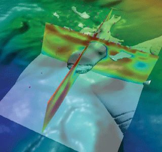
Before the survey, we can complete feasibility studies for survey design and monitoring. EMVision® incorporates multiple components, inline and azimuthal data with anisotropy in full 3D for complete and accurate modeling of the true physics. Once the survey is complete, TechnoImaging® will create the highest quality model from your data. The richness of 3D data sets is fully incorporated with joint inversion of inline and azimuthal data with multiple components and anisotropy. Your a priori data from well-constraints or seismic can also be included to provide the most accurate subsurface images available. In addition, we can perform joint inversion of MT and MSCEM to reduce uncertainty further. We deliver models with sharp boundaries by using our patented focusing regularization techniques.
All models and data are delivered in industry-standard format. All processing is done on our powerful, secure, in-house cluster. Please contact us for more technical details, or refer to our peer-reviewed and refereed papers here.

